
Nitin Das and Rahul Saxena with AiDash

On this week's Industrial Talk we're talking to Rahul Saxena and Nitin Das, Co-Founders of AI Dash about “Satellites 101, Today's Impact and Future Benefits”. Get the answers to your “Satellite” questions along with Rahul and Nitins's unique insight on the “How” on this Industrial Talk interview!
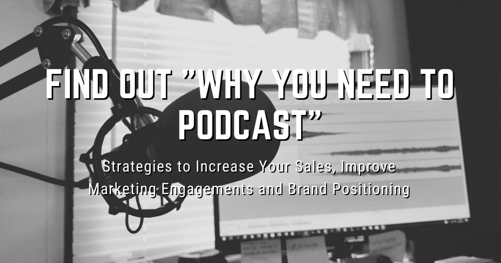
Finally, get your exclusive free access to the Industrial Academy and a series on “Why You Need To Podcast” for Greater Success in 2022. All links designed for keeping you current in this rapidly changing Industrial Market. Learn! Grow! Enjoy!
NITIN DAS' CONTACT INFORMATION:
Personal LinkedIn: https://www.linkedin.com/in/nitindas1/
Company LinkedIn: https://www.linkedin.com/company/aidash/
Company Website: https://www.aidash.com/
RAHUL SAXENA'S CONTACT INFORMATION:
Personal LinkedIn: https://www.linkedin.com/in/saxenarahul1/
Company LinkedIn: https://www.linkedin.com/company/aidash/
Company Website: https://www.aidash.com/
PODCAST VIDEO:
THE STRATEGIC REASON “WHY YOU NEED TO PODCAST”:
OTHER GREAT INDUSTRIAL RESOURCES:
NEOM: https://www.neom.com/en-us
AI Dash: https://www.aidash.com/
Hitachi Vantara: https://www.hitachivantara.com/en-us/home.html
Industrial Marketing Solutions: https://industrialtalk.com/industrial-marketing/
Industrial Academy: https://industrialtalk.com/industrial-academy/
Industrial Dojo: https://industrialtalk.com/industrial_dojo/
We the 15: https://www.wethe15.org/
YOUR INDUSTRIAL DIGITAL TOOLBOX:
LifterLMS: Get One Month Free for $1 – https://lifterlms.com/
Active Campaign: Active Campaign Link
Social Jukebox: https://www.socialjukebox.com/
Industrial Academy (One Month Free Access And One Free License For Future Industrial Leader):

Business Beatitude the Book
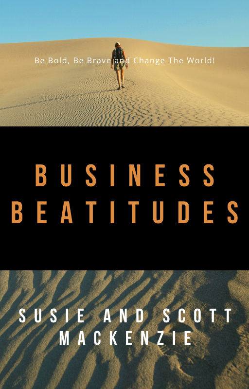
Do you desire a more joy-filled, deeply-enduring sense of accomplishment and success? Live your business the way you want to live with the BUSINESS BEATITUDES…The Bridge connecting sacrifice to success. YOU NEED THE BUSINESS BEATITUDES!
TAP INTO YOUR INDUSTRIAL SOUL, RESERVE YOUR COPY NOW! BE BOLD. BE BRAVE. DARE GREATLY AND CHANGE THE WORLD. GET THE BUSINESS BEATITUDES!
Reserve My Copy and My 25% Discount
PODCAST TRANSCRIPT:
SUMMARY KEYWORDS
satellite, ai, listeners, utility, succeed, conversation, rahul, wildfire, called, industrial, bands, technology, talking, images, innovations, solving, dash, capture, launched, vegetation management
Welcome to the industrial talk podcast with Scott Mackenzie. Scott is a passionate industry professional dedicated to transferring cutting edge industry focused innovations and trends while highlighting the men and women who would keep the world moving. So put on your hard hat, grab your work boots,
and let's get right once again, welcome to industrial talk the number one industrial related podcast in the universe that celebrates you, the industry professionals, the companies that get it done. You are bold, you are brave, you dare greatly. Absolutely. And you are changing lives. You're solving problems. You're changing the world. How can we argue about that? Also, this is sort of unique. So take a note of this. This will also be rebroadcast on a new podcast called satellite superheroes. Now we're going to be identifying how satellites, the technology and satellites will benefit industry as a whole. It is exciting, it is absolutely amazing innovation. All right, we've got in the hot seat, speaking of satellites, Nitin Das, and Rahul Saxena with AI Dash. And we're gonna just start talking about that satellite 101. Because I need to know that all right, let's get cracking.
They're doing so many things with satellite that and I don't even know that the technology is mad, just mad. And AI Dash is leading the way, definitely on how that is really impacting industry as a whole. So it's a big game, big deal. But before we get into that, I want to make sure that we've been talking a lot about are you getting the most out of dot, dot, dot, you're getting the most out of your engagements getting the most out, I'm all about marketing, you just just got to know about that. And I think marketing as a whole is really important to your sales, right? It makes sense, right? There goes hand in hand. And I think marketing drives the sales organizations, the sales activity, and really just sales is a confirmation of of what's been talked about in marketing. That's just me, we can expand upon that. But I have been really sort of talking about, Hey, are you getting the most out of you got to ask those questions, especially today getting the most out of whatever it is fill in the blank. The other thing is that I want to be able to just sort of begin sharing of how I sort of look at markets and how I help clients succeed. One, you find that target, who are they 50, just this just let's keep it manageable, not a not a scattergun approach of let's say, 30 or 15,000. That's a tough one, I don't know how to, I don't know how to filter those out. But let's just say we identify and we do our research, and we identify 5050 is manageable, and then that 50, we identify the why we want to connect with them why this is an important contact, why this is strategic for the success of our company, figure that out. And then from there, be able to create that plan of attack that how to help them, whoever those targets succeed. If you truly have a passion to work with these companies, these individuals, you've got to help them succeed. Does that happen right off the bat? No, you're half to create the relationships. But at the heart, right here at the heart, you want to help them succeed. Because if they're happy, and they are successful, everybody's happy. And everybody succeeds. And that is really the goal. So when you start to identify those, those prospects that are important and strategic to your business, and answer the why they are, then you develop that strategy that helps them succeed, whatever that might be, due to, you know, hey, I was thinking about you, here it is, or what I do is like, you got to get on the podcast, you got to elevate that voice. You've got to get that message out there. You got to tell that story because it impacts and helps people succeed. That's how I roll so get the most out of target your prospects understand that why whittle it down? Right? Get? You know, let's just be honest here. In your scatter gun, 15 30,000, whatever, list, there is a small portion that are truly meaningful and strategic to your business. Let's just, why don't we just cut right to the chase, identify that all the tools are out there to make that happen? Why waste your time? Sure. You can keep hammering this stuff out there and hopefully somebody comes to the website and hopefully something. No, no, no, no, no, no, no. Let's be very strategic on who we connect with and help them succeed. Just That's how I grew a business took it public. That's how I took another company and sold it is just, I wanted to truly solve problems for them to help them succeed. All right. Now, again, you heard me allude to it. This is satellite superheroes, which is a new podcast, and it's all part of the industrial talk network, where we're going to be able to, and where we are highlighting incredible professionals, incredible companies that are delivering innovations in their specific space and does real talk. Yeah, I can be pretty high level. But the reality is that we need to have this conversation in satellites. We do, we need to begin tapping in to these individuals that understand the impact the positive impact of what is taking place in the world of satellites, from an industrial perspective, from an environmental perspective, from you know, in, in this case, we're gonna be talking vege management's perspective, it is powerful, it is transformative, and it is going to change the way we do business going forward. And the reality is, we need this businesses, if you really want to have that business that is resilient. If you want to really have that business that
knows what to do and when to do it. And be able to deploy your capital in the right way. You need innovations, like what we're going to be talking about from AI Dash is satellite is huge, and it's only getting better. wait to hear what is taking place. I'm telling you right now, in the world of satellite, and the reason why this particular conversation is so interesting. First, it's a launch to it is from my perspective, that sort of satellite one conversation I I don't know anything, I know they go up in a rocket and they get out there and they get into the right orbit and they do things. But the reality is, is that it's mad innovation, and these are incredible solutions. Alright, let's get on to it. Nitin and Rahul AI Dash, they are co founders of that particular company. And I'm just telling you, we're gonna be talking about satellites, satellite 101. How how satellites are positively impacting the way vegetation management happens and other things. So really enjoy this conversation. All right, welcome to industrial talk. We have Nitin Das, and Rahul. Okay, a set Saxena. Can I do it?
Yeah, that's fine. That will do.
Alright listeners in your face. I got the names right. All right. We are talking AI Dash we are talking about satellites. We're talking about utilities. We're talking about how the use of satellite technology AI is is going to significantly if not now significantly improve vegetation manage within the utility space and as an old crotchety crusty, journeymen utility lineman. I love this topic. So I will be geeking out listeners because well, it's an important topic to have. And I think it's going to be just absolutely transformative when it comes to managing vegetation within the utility space. I like it. It's a cool topic. All right, before we get into that, Nitin, for the listeners out there, give us a little 411 a little background on who you are, and why you're such an incredible professional, and then I'll throw it to you Rahu.
Okay, so hi, everyone. I'm Nathan. So I'm one of the co founder and chief AI officer at the AI Dash. So here, in addition, basically taking care of all the research and development over AI ml solutions, around 18 plus years of experience with a computer science background. And for the last many years, I'm mostly into AI ml technology, and building solutions around that.
It's, I have a number of conversations with ai, ai technology, machine learning, simulations, data and all of that stuff. And this is just, this is a fascinating, and you're right at the cutting edge, which is very cool of how you're deploying that AI platform technology in the world of satellites, which is it benefits us tonight. I'm a big fan of that. Rahul, give us a little background on who you are.
Yeah, hi everyone. This is Rahul am Co-Founder and CTO at AI Dash. So around about 20 years of experience. Some of them was work around building enterprise security software at RSA Security. So did a lot of I mean, right from design development to management around building the software's for large enterprises, fortune 500 enterprises, a bit of startup experience on brambly on the b2c space. So mix of you know entrepreneurship and technical roles. So at AI Dash I look at, you know, building all these different cool applications based on the I mean the cool stuff which Nathan is doing and the AI side and building the platform around that.
Say Allah listeners, this is going to be a great conversation, as I alluded to just because we've got two incredible professionals with mad skills in the world of technology. And and what makes it exciting for me, outside of the fact I love the utility space, the power space, the energy space, is that I think there's a tremendous transformation that is going to have to happen within the utility world. And I think that it's wonderful that you guys are leading that that charge now. Many of the listeners, I am going to be candid with you many of the listeners know of satellites, no of, you know, yeah, hey, I've got my dish, and I guess I'm getting, you know, whatever the, but there's a lot more to it. If if you could give us Rahu, some sort of that historical perspective of satellites, would be it sort of lay that foundation, and then we're going to expand from there.
Sure, sure. So the first artificial satellite, or you know, the era of remote sensing began with this satellite called Sputnik one, which was launched has, you know, as early as 1957. So it's been what around 65 years since the first remote sensing satellite was launched. So that was the first satellite which could complete the orbit of Earth every 96 minutes, and can transmit signals which can be received by Earth, right. That's where the remote sensing error kind of began. Back almost 65 years back over a period of time, you know, this space has really evolved. So it started with, let's say, a single sensor, which was more optical, and you can just see, like, you know, the camera image, what you see for your normal camera, eventually, from, let's say, 60s to 80s, it started getting into multispectral, which started capturing more bands. And met them is an expert that can deep dive more into, you know, what those bands are, from there, we got into radio images, thermal images over next two years. And I think, for last couple of decades, the journey has been, rather than having very large satellites, to what they call nano satellites, or smaller satellites, which are very small, and rather than, you know, launching a very large satellite, which is very costly and takes a lot of time, you can actually have, you know, a very small dimension satellite, which you can, you can launch multiple of them, have a constellation of them. So that's where the world has evolved. So just starting from, you know, these funds,
I'm writing this stuff down, and I'm going to nano satellites, and a cluster I'm all about that is incredible. I didn't know, and it was interesting, back to Sputnik. And I read about it and all that stuff. Really the the premise behind Sputnik as a result of just a satellite is to be able to say it's transmitting PPP, whatever it is, and we're receiving. So we've just proved that we can do up here and and receive whatever that signal and that is, that is a sort of a leap forward in the advancement of technology. I've got to ask, and this is a two unit and how many satellites are being launched every year? Right. And then Then, can you explain for the listeners and and Rahul mentioned it bands? I don't know. Explain a little bit of that. Thanks.
Sure. Sure, definitely. So, as we have seen the natural progression of the satellite. So the these days 1000 new satellites launched every year. And I would like to say basically the different types of satellites basic like started from our observation, then terrestrial multispectral satellite SAR hyperspectral in multi sensor satellites are there. So in the multi spectral, basically, there are multiple bands having different frequencies and different wavelengths. So those are called basically the red, green, blue, and I our red edge, and SW IR, that is shortwave infrared bands. And combination of these bands can be used for solving different kinds of problems. So that that is basically the multispectral part. There are the different kinds of satellites called the thermal satellites. Basically they capture the thermal signature of any object on the arc. So that is the thermal sink thermal satellite, hypersonic hyperspectral satellites are basically having more than 200 Plus continuous bands, and they basically will open up a new era for basically solving different kinds of problems which which can be solved through multispectral satellite. And there is another kind of satellite called SAR that is a synthetic aperture at synthetic apertures satellite. If you if you look at optical satellites, though there is a limitation they basically can't see through, they can't see in the night and can't see through the cloud. But there are synthetic aperture radar satellite, those are called Radio satellites, they can see they can penetrate through the cloud. And they can also see objects in the night as well. So these are the different kinds of satellites with the with the corresponding bands
of the satellites. And you bring up a good point because you just said, Hey, satellite could be this satellite could be that this is we could see this, we could see whatever it's it's, it's amazing technology of how does how to if I'm a satellite person, how do I manage that 1000? You know, new satellite inventory, given? What I have here, right? What what is being launched? That's SD unit? And how did how do they make that determination? Or are all satellites multi capable?
No, so all the satellites are not multi capable. So there are basically multiple sensors installed on some on on a single satellite. But for example, let's say thermoset light. So there is a single sensor, there's a thermal sensor, and a SAR satellite is a single SAR sensor. So yeah, so based on based on the use case, based on all other things, basically, they basically installed multiple sensor or multiple camera on a single satellite.
And it's just gonna get more and more, right. It's just, it's just, and the technology is just going to continue to advance and it just like anything else, it's definitely not static. It's a very dynamic type of environment. Now let's talk a little bit about that. Me old crotchety, crusty journeyman lineman, I'm a, you know, I'm all about that human inspection, I got in a truck, and I went down, I looked at that tower, and I climbed that tower. And then I looked at that insulator, oh, that insulator, and that was very labor intensive, right. And so then here comes drones, drones were like, all right here, now I can see it and take great pictures. And then, of course, LiDAR, and so on. explain to the listeners of the difference between, let's say, the drone LIDAR human approach versus the satellite. why that is? So I think that's transformative. Can. Rahul, could you sort of help that? Argument? Why the question.
Yeah. Yeah, sure. So I think the biggest difference there is in terms of sheer scale, which satellite can do the shed satellite, like I mentioned, I mean, starting from Sputnik era, which was covering the whole earth in 96 minutes. So there's a there's a massive coverage, which is happening pretty rapidly, right. So none of the options you mentioned, like LiDAR, whether it is a drone, a drone, or a helicopter, or obviously, for human beings, it's not possible to scale at that rapid speed. So So for example, a satellite can capture very large areas, like up to, let's say, 1000 square kilometers, which is just not possible in you know, drones, or, I mean, from a human angle. So that's, that's one of the major differences. So if you are looking at so obviously, I mean, if you keep going a bit far from the subject, the resolution might drop a bit. But it is more than compensated by the sheer scale by which you know, you can get this imagery captured. Apart from that, since satellite imagery, you know, keeps taking the image and keep sending it to Earth, over a period of time you get archives or archives of these imagery, right? So if I'm looking at an area, I just, I'm not just getting an image as of today, right? Whether it is human or drone, or LiDAR, you can just capture what is there today, right? Unless you have you have been doing this for a very long time. In satellite, I can actually go go to the past and make a future prediction. Right, I can see the pattern and make a prediction based on that.
See, and I like that. And listeners, that means that that I have a picture. Let's say I have a picture a week ago, I have a picture today I have a picture a month ago. And and and Nitin correct me if I'm wrong, through the AI capability, be able to determine because the key here is, and I would imagine, correct me is that, hey, I want to I'm a utility. I have vegetation management, that is a cost to me, and I want to deploy my money efficiently. Don't go over here, go over there and be able to communicate and deliver that type of insights. Because you have that those multi pictures vision of from above, is that correct?
Yeah, so basically, you take pictures at multiple point of time, and you can basically estimate the change between these two images. And that case that change can be translated into, into a problem statement, something like that.
Yeah. Yeah, as, as I, when I was doing patrol work, the the reality is this, this, if there was a rain and there was a eucalyptus, I knew that that was going to grow. And so I'd have to get in the truck and get my, you know, and go out there and cut or waste my time and go out there and say, Oh, I still have clearance from whatever the power line CIO or whatever it might be. It was, it is an Prowl, it is the ability to be able to truly deploy. It's my money. This is, you know, dollars and cents my maintenance dollars in vegetation management to the right, and can I see the type of tree it is like, the, the type of tree, here's eucalyptus, here's, oh, here's this and be able to also have that determination. Is that a possibility? So you can see, I can, like, I geek out on this stuff, because I have that same problem. Can I do that?
Yeah, sure. I think. Sorry. Yeah. Go ahead.
I just give you a high level, and then maybe you can add to it. So yeah, I think there are two things here. So from this perspective, I think, yeah, I mean, it's a problem, which, obviously, with his algorithms he can solve. The other angle here is it also depends upon what you are, what you need from this solution. Right? So if when satellite imagery, I can go back to the past, while I'm looking at is whether it's a eucalyptus tree, whether it is some other tree, what's the growth rate? What's the clearance, right? So if, if I'm inspecting manually, so if it is a eucalyptus tree, I understand the growth rate, and we can make up cycle 10 prediction based on that. But if I am, you know, just having this data independent of the specie of the tree, I can make a prediction independent of the specie of the tree. Right. So, so knowing the specie of free becomes slightly less important. But yeah, to your point, I think you can you can add more around, you know, especially if
I was iterating. The same thing, basically. So with the current set of images, you can basically get the current state of the vegetation, but you you, and with basically the historical images, you can estimate the growth rate of each of the tree. Without knowing this issue, we don't require the species because we we estimated the growth rate of each and every tree within a given area of interest.
Do you in to this as to unit and do you also in your AI? Solution? Incorporate weather?
Yes, weather is an important factor, which basically weather soil all these basically, variables are, are the part of a fader a model.
It then it dovetails nicely with the next question, and this is to unit and it's there is a lot of chatter, a lot of discussion around disaster management we see. Right, it just happens. It's, it's gonna, sadly, it will happen again this year, and we're going to have that same conversation and it's just going to with the the AI satellite solution. How does that help with that? How does it minimize and be able to sort of elevate that disaster conversation?
Sure, definitely. So I'll basically give you an example of wildfire how how the satellite can be used in the wildfire. So there are three components in wildfire, the precondition before the wildfire, during the wildfire and the post after after the wildfire happens. So before the wildfire the satellite data is used to identify the wildfire risk risk zones, which can be used for hardening the infrastructures and on so if you already know in advance, what all areas are important for wildfire perspective, low mid high, categorize those in globey time, then utilities can take appropriate actions before time to for hardening the grid, and all those things during the wildfire because there's a natural calamity which can't be avoided. So if the wildfire is happening to satellite data can be used for basically estimating the direction in the speed of the wildfire. And then the utility can take appropriate actions. For example, the evac evacuation on time, so if they know the direction isn't all and post wildfires, basically, the post wildfire damage can be estimated through satellite data, which can be used for restoration and many other purposes.
I'm having a hard time poking holes in your value proposition for utilities. I mean, it makes sense. So if I'm a utility I've had this conversation with utilities is that they're having, they're having challenges less like everybody else. And the challenge is, is I got workforce management. You know, how do I find the right reputable tree? Company to trim? And then why do I do? They're, they're struggling. And and this is a huge budget component to their business just is it's it's a. And if I, if I was a utility company, I would definitely take note, because I think that this, this is a fad, and it's only gonna get better. Right? The it's just let me ask you this, let me ask you this. So with that, with that statement, it's only going to get better. Where do we see it going? Rahul?
Sure. So I believe, I think one way is to look at is extrapolate the history discussion we had at the beginning of this conversation. So it's going to continue the same way, we had till nano satellites, we are talking about actually pico satellites, which can be even smaller, so more satellites and more coverage, maybe miss use cases, we are also looking at, as more of more of this image becomes available, I mean, there'll be some commercial satellites, there will be some satellites launched by government. So more data becomes available, more kind of models are possible, as we go along, the AI becomes better. And then as we are going forward, and especially this becomes important for things like you know, monitoring for let's say, a wildfire, or a storm and those kind of things. So, the time travel between you know, the signal coming from space to Earth, a lot of work happening on that side as well right. So, how to reduce that time. So, the moment a satellite captures, can Are there ways the signal can be captured very quickly on Earth, so that some action can be taken. So those would be other areas, which we feel there will be more advances.
I like again, I keep on stubbing my toe on the Nano idea. I can't, I just have to ask it. Now, what's a nano sat How big is a nano satellite, I mean, just physically.
So basically, let me let me just give you a complete figure so that you will basically have an understanding of the progression in the size of the satellites. So initial, when the Sputnik or the initial phases of satellite, those satellites, basically the the weight of those satellites were around 100 to 500 kg, a single satellite, then there came the micro satellites, the weight got reduced to 5200 kg, then there came on nanosatellites, the weight still got reduced to less than 10 kg. And there's there's a new set of satellites called the PICO satellites, the weight is around 100 grams to one kg. So that is the new set of satellites.
Come on, listeners, you got to admit that that's pretty cool. That's a great conversation. When I was a boy, I, I was a big fan of Estus rockets. So I would always shoot off these rockets right. Now, I guess I can get as this rocket and put one of those dog on satellites, if it was powerful enough breaking the Earth at the pole. Oh, that is so that's exciting. And you know what else and I sort of dovetail everybody's talking about all the stuff that's in, in, in space right now. But those, those really small satellites address that. I mean, it's it's not a big clunky thing out there, right? It's, they really do they address that. And from a cost perspective, I mean, I can throw a bunch of them in there and and zip it out there and and and so, I get greater bang for the buck for that whatever that that you know, rocket
and I would like to add one more thing. So along with the basically the change in the size of the satellite, there is also an increase in the resolution. So basically, initially, the resolution was around 5200 meters, the and now the resolution is basically tents. I mean 30 centimeter, 20 centimeter and 50 centimeters, very high resolution satellites.
Again, add to Rose. I mean, it's gonna it's gonna continue to be better. It's just, it's just gonna continue. I don't know if I'm scared or, or excited or whatever, but that's a that's a heck of a conversation. All right, we're gonna have to wrap it up outside because I would I'd love to continue to talk about it. However, Rahul, how does somebody get a hold of you? Like email what but, you know, they they said, Hey, Rahul spoke to my heart about satellites. How do they get ahold of you?
Yeah, he will work. I'm on LinkedIn. So So in any of these medium, I'm available.
Very good and to you knit and how did they get ahold of you too as well?
The same medium, which basically the whole mentioned.
I gotta tell you, gents, this was a great conversation I really enjoyed. And I know that we just really just scratched the surface on what you guys are doing at AI Dash and what, what's taking place in how you are. I hate to say it but passionate about helping utilities and their vegetation management, leveraging the technology leveraging satellite hack, have a conversation. Well done to you both. I enjoyed that conversation. Thanks. All right, listeners, you're saying to yourself, Scott, I do want to go, just go out to industrial talk.com You go out to industrial talk.com You will have both all of the contact information, AI Dash everything that you need to pursue additional information from these two individuals. I gotta tell you, I really enjoyed it. All right, listeners, we're gonna wrap it up on the other side. So stay tuned, do not go away.
You're listening to the industrial talk Podcast Network.
About that conversation at is absolutely amazing enjoyed it. With Nitin and Rahul with AI Dash. The future is bright. When it comes to industrial solutions, you got to check out AI Dash go to AI Dash.com. Also, you need to go and support satellite superheroes. And the reason you need to do that is because we're going to constantly begin to break down all of the great technology that is impacting in a positive way. industry as a whole and you need to be engaged, you need to take on that learning requirement because you need to, you need to learn, you need to collaborate and you're going to innovate. That's the reality of the situation. Alright, if you're looking also at me, in my I'm in my jacket for the first time in a long time, had a meeting and I'm still wearing the jacket. So check it off. It's all good. All right, again, let's be a ecosystem that is truly helpful in solving problems and allowing other companies succeed. All right, we're gonna have another great conversation round a corner. People will be brave daring greatly, and you're gonna change the world.
Transcript
Welcome to the industrial talk podcast with Scott Mackenzie. Scott is a passionate industry professional dedicated to transferring cutting edge industry focused innovations and trends while highlighting the men and women who would keep the world moving. So put on your hard hat, grab your work boots,
and let's get right once again, welcome to industrial talk the number one industrial related podcast in the universe that celebrates you, the industry professionals, the companies that get it done. You are bold, you are brave, you dare greatly. Absolutely. And you are changing lives. You're solving problems. You're changing the world. How can we argue about that? Also, this is sort of unique. So take a note of this. This will also be rebroadcast on a new podcast called satellite superheroes. Now we're going to be identifying how satellites, the technology and satellites will benefit industry as a whole. It is exciting, it is absolutely amazing innovation. All right, we've got in the hot seat, speaking of satellites, Nitin Das, and Rahul Saxena with AI Dash. And we're gonna just start talking about that satellite 101. Because I need to know that all right, let's get cracking.
our research, and we identify:knows what to do and when to do it. And be able to deploy your capital in the right way. You need innovations, like what we're going to be talking about from AI Dash is satellite is huge, and it's only getting better. wait to hear what is taking place. I'm telling you right now, in the world of satellite, and the reason why this particular conversation is so interesting. First, it's a launch to it is from my perspective, that sort of satellite one conversation I I don't know anything, I know they go up in a rocket and they get out there and they get into the right orbit and they do things. But the reality is, is that it's mad innovation, and these are incredible solutions. Alright, let's get on to it. Nitin and Rahul AI Dash, they are co founders of that particular company. And I'm just telling you, we're gonna be talking about satellites, satellite 101. How how satellites are positively impacting the way vegetation management happens and other things. So really enjoy this conversation. All right, welcome to industrial talk. We have Nitin Das, and Rahul. Okay, a set Saxena. Can I do it?
Yeah, that's fine. That will do.
Alright listeners in your face. I got the names right. All right. We are talking AI Dash we are talking about satellites. We're talking about utilities. We're talking about how the use of satellite technology AI is is going to significantly if not now significantly improve vegetation manage within the utility space and as an old crotchety crusty, journeymen utility lineman. I love this topic. So I will be geeking out listeners because well, it's an important topic to have. And I think it's going to be just absolutely transformative when it comes to managing vegetation within the utility space. I like it. It's a cool topic. All right, before we get into that, Nitin, for the listeners out there, give us a little 411 a little background on who you are, and why you're such an incredible professional, and then I'll throw it to you Rahu.
Okay, so hi, everyone. I'm Nathan. So I'm one of the co founder and chief AI officer at the AI Dash. So here, in addition, basically taking care of all the research and development over AI ml solutions, around 18 plus years of experience with a computer science background. And for the last many years, I'm mostly into AI ml technology, and building solutions around that.
It's, I have a number of conversations with ai, ai technology, machine learning, simulations, data and all of that stuff. And this is just, this is a fascinating, and you're right at the cutting edge, which is very cool of how you're deploying that AI platform technology in the world of satellites, which is it benefits us tonight. I'm a big fan of that. Rahul, give us a little background on who you are.
Yeah, hi everyone. This is Rahul am Co-Founder and CTO at AI Dash. So around about 20 years of experience. Some of them was work around building enterprise security software at RSA Security. So did a lot of I mean, right from design development to management around building the software's for large enterprises, fortune 500 enterprises, a bit of startup experience on brambly on the b2c space. So mix of you know entrepreneurship and technical roles. So at AI Dash I look at, you know, building all these different cool applications based on the I mean the cool stuff which Nathan is doing and the AI side and building the platform around that.
Say Allah listeners, this is going to be a great conversation, as I alluded to just because we've got two incredible professionals with mad skills in the world of technology. And and what makes it exciting for me, outside of the fact I love the utility space, the power space, the energy space, is that I think there's a tremendous transformation that is going to have to happen within the utility world. And I think that it's wonderful that you guys are leading that that charge now. Many of the listeners, I am going to be candid with you many of the listeners know of satellites, no of, you know, yeah, hey, I've got my dish, and I guess I'm getting, you know, whatever the, but there's a lot more to it. If if you could give us Rahu, some sort of that historical perspective of satellites, would be it sort of lay that foundation, and then we're going to expand from there.
ed has, you know, as early as:I'm writing this stuff down, and I'm going to nano satellites, and a cluster I'm all about that is incredible. I didn't know, and it was interesting, back to Sputnik. And I read about it and all that stuff. Really the the premise behind Sputnik as a result of just a satellite is to be able to say it's transmitting PPP, whatever it is, and we're receiving. So we've just proved that we can do up here and and receive whatever that signal and that is, that is a sort of a leap forward in the advancement of technology. I've got to ask, and this is a two unit and how many satellites are being launched every year? Right. And then Then, can you explain for the listeners and and Rahul mentioned it bands? I don't know. Explain a little bit of that. Thanks.
satellite. So the these days:person, how do I manage that:No, so all the satellites are not multi capable. So there are basically multiple sensors installed on some on on a single satellite. But for example, let's say thermoset light. So there is a single sensor, there's a thermal sensor, and a SAR satellite is a single SAR sensor. So yeah, so based on based on the use case, based on all other things, basically, they basically installed multiple sensor or multiple camera on a single satellite.
And it's just gonna get more and more, right. It's just, it's just, and the technology is just going to continue to advance and it just like anything else, it's definitely not static. It's a very dynamic type of environment. Now let's talk a little bit about that. Me old crotchety, crusty journeyman lineman, I'm a, you know, I'm all about that human inspection, I got in a truck, and I went down, I looked at that tower, and I climbed that tower. And then I looked at that insulator, oh, that insulator, and that was very labor intensive, right. And so then here comes drones, drones were like, all right here, now I can see it and take great pictures. And then, of course, LiDAR, and so on. explain to the listeners of the difference between, let's say, the drone LIDAR human approach versus the satellite. why that is? So I think that's transformative. Can. Rahul, could you sort of help that? Argument? Why the question.
areas, like up to, let's say,:See, and I like that. And listeners, that means that that I have a picture. Let's say I have a picture a week ago, I have a picture today I have a picture a month ago. And and and Nitin correct me if I'm wrong, through the AI capability, be able to determine because the key here is, and I would imagine, correct me is that, hey, I want to I'm a utility. I have vegetation management, that is a cost to me, and I want to deploy my money efficiently. Don't go over here, go over there and be able to communicate and deliver that type of insights. Because you have that those multi pictures vision of from above, is that correct?
Yeah, so basically, you take pictures at multiple point of time, and you can basically estimate the change between these two images. And that case that change can be translated into, into a problem statement, something like that.
Yeah. Yeah, as, as I, when I was doing patrol work, the the reality is this, this, if there was a rain and there was a eucalyptus, I knew that that was going to grow. And so I'd have to get in the truck and get my, you know, and go out there and cut or waste my time and go out there and say, Oh, I still have clearance from whatever the power line CIO or whatever it might be. It was, it is an Prowl, it is the ability to be able to truly deploy. It's my money. This is, you know, dollars and cents my maintenance dollars in vegetation management to the right, and can I see the type of tree it is like, the, the type of tree, here's eucalyptus, here's, oh, here's this and be able to also have that determination. Is that a possibility? So you can see, I can, like, I geek out on this stuff, because I have that same problem. Can I do that?
Yeah, sure. I think. Sorry. Yeah. Go ahead.
I just give you a high level, and then maybe you can add to it. So yeah, I think there are two things here. So from this perspective, I think, yeah, I mean, it's a problem, which, obviously, with his algorithms he can solve. The other angle here is it also depends upon what you are, what you need from this solution. Right? So if when satellite imagery, I can go back to the past, while I'm looking at is whether it's a eucalyptus tree, whether it is some other tree, what's the growth rate? What's the clearance, right? So if, if I'm inspecting manually, so if it is a eucalyptus tree, I understand the growth rate, and we can make up cycle 10 prediction based on that. But if I am, you know, just having this data independent of the specie of the tree, I can make a prediction independent of the specie of the tree. Right. So, so knowing the specie of free becomes slightly less important. But yeah, to your point, I think you can you can add more around, you know, especially if
I was iterating. The same thing, basically. So with the current set of images, you can basically get the current state of the vegetation, but you you, and with basically the historical images, you can estimate the growth rate of each of the tree. Without knowing this issue, we don't require the species because we we estimated the growth rate of each and every tree within a given area of interest.
Do you in to this as to unit and do you also in your AI? Solution? Incorporate weather?
Yes, weather is an important factor, which basically weather soil all these basically, variables are, are the part of a fader a model.
It then it dovetails nicely with the next question, and this is to unit and it's there is a lot of chatter, a lot of discussion around disaster management we see. Right, it just happens. It's, it's gonna, sadly, it will happen again this year, and we're going to have that same conversation and it's just going to with the the AI satellite solution. How does that help with that? How does it minimize and be able to sort of elevate that disaster conversation?
Sure, definitely. So I'll basically give you an example of wildfire how how the satellite can be used in the wildfire. So there are three components in wildfire, the precondition before the wildfire, during the wildfire and the post after after the wildfire happens. So before the wildfire the satellite data is used to identify the wildfire risk risk zones, which can be used for hardening the infrastructures and on so if you already know in advance, what all areas are important for wildfire perspective, low mid high, categorize those in globey time, then utilities can take appropriate actions before time to for hardening the grid, and all those things during the wildfire because there's a natural calamity which can't be avoided. So if the wildfire is happening to satellite data can be used for basically estimating the direction in the speed of the wildfire. And then the utility can take appropriate actions. For example, the evac evacuation on time, so if they know the direction isn't all and post wildfires, basically, the post wildfire damage can be estimated through satellite data, which can be used for restoration and many other purposes.
I'm having a hard time poking holes in your value proposition for utilities. I mean, it makes sense. So if I'm a utility I've had this conversation with utilities is that they're having, they're having challenges less like everybody else. And the challenge is, is I got workforce management. You know, how do I find the right reputable tree? Company to trim? And then why do I do? They're, they're struggling. And and this is a huge budget component to their business just is it's it's a. And if I, if I was a utility company, I would definitely take note, because I think that this, this is a fad, and it's only gonna get better. Right? The it's just let me ask you this, let me ask you this. So with that, with that statement, it's only going to get better. Where do we see it going? Rahul?
Sure. So I believe, I think one way is to look at is extrapolate the history discussion we had at the beginning of this conversation. So it's going to continue the same way, we had till nano satellites, we are talking about actually pico satellites, which can be even smaller, so more satellites and more coverage, maybe miss use cases, we are also looking at, as more of more of this image becomes available, I mean, there'll be some commercial satellites, there will be some satellites launched by government. So more data becomes available, more kind of models are possible, as we go along, the AI becomes better. And then as we are going forward, and especially this becomes important for things like you know, monitoring for let's say, a wildfire, or a storm and those kind of things. So, the time travel between you know, the signal coming from space to Earth, a lot of work happening on that side as well right. So, how to reduce that time. So, the moment a satellite captures, can Are there ways the signal can be captured very quickly on Earth, so that some action can be taken. So those would be other areas, which we feel there will be more advances.
I like again, I keep on stubbing my toe on the Nano idea. I can't, I just have to ask it. Now, what's a nano sat How big is a nano satellite, I mean, just physically.
es, the weight got reduced to:Come on, listeners, you got to admit that that's pretty cool. That's a great conversation. When I was a boy, I, I was a big fan of Estus rockets. So I would always shoot off these rockets right. Now, I guess I can get as this rocket and put one of those dog on satellites, if it was powerful enough breaking the Earth at the pole. Oh, that is so that's exciting. And you know what else and I sort of dovetail everybody's talking about all the stuff that's in, in, in space right now. But those, those really small satellites address that. I mean, it's it's not a big clunky thing out there, right? It's, they really do they address that. And from a cost perspective, I mean, I can throw a bunch of them in there and and zip it out there and and and so, I get greater bang for the buck for that whatever that that you know, rocket
ly, the resolution was around:Again, add to Rose. I mean, it's gonna it's gonna continue to be better. It's just, it's just gonna continue. I don't know if I'm scared or, or excited or whatever, but that's a that's a heck of a conversation. All right, we're gonna have to wrap it up outside because I would I'd love to continue to talk about it. However, Rahul, how does somebody get a hold of you? Like email what but, you know, they they said, Hey, Rahul spoke to my heart about satellites. How do they get ahold of you?
Yeah, he will work. I'm on LinkedIn. So So in any of these medium, I'm available.
Very good and to you knit and how did they get ahold of you too as well?
The same medium, which basically the whole mentioned.
I gotta tell you, gents, this was a great conversation I really enjoyed. And I know that we just really just scratched the surface on what you guys are doing at AI Dash and what, what's taking place in how you are. I hate to say it but passionate about helping utilities and their vegetation management, leveraging the technology leveraging satellite hack, have a conversation. Well done to you both. I enjoyed that conversation. Thanks. All right, listeners, you're saying to yourself, Scott, I do want to go, just go out to industrial talk.com You go out to industrial talk.com You will have both all of the contact information, AI Dash everything that you need to pursue additional information from these two individuals. I gotta tell you, I really enjoyed it. All right, listeners, we're gonna wrap it up on the other side. So stay tuned, do not go away.
You're listening to the industrial talk Podcast Network.
About that conversation at is absolutely amazing enjoyed it. With Nitin and Rahul with AI Dash. The future is bright. When it comes to industrial solutions, you got to check out AI Dash go to AI Dash.com. Also, you need to go and support satellite superheroes. And the reason you need to do that is because we're going to constantly begin to break down all of the great technology that is impacting in a positive way. industry as a whole and you need to be engaged, you need to take on that learning requirement because you need to, you need to learn, you need to collaborate and you're going to innovate. That's the reality of the situation. Alright, if you're looking also at me, in my I'm in my jacket for the first time in a long time, had a meeting and I'm still wearing the jacket. So check it off. It's all good. All right, again, let's be a ecosystem that is truly helpful in solving problems and allowing other companies succeed. All right, we're gonna have another great conversation round a corner. People will be brave daring greatly, and you're gonna change the world.